Nepal's Flood Disaster Was Not Invisible. It Was Waiting Upstream
The Himalayan flood arrived suddenly, but the exposure of roads, hydropower projects and settlements had been building for years.
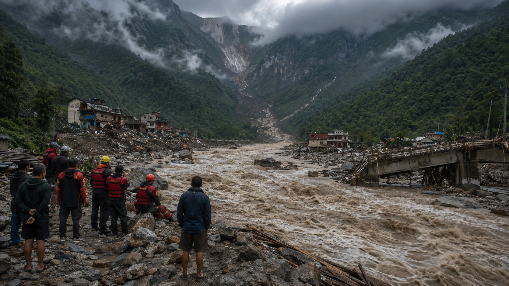
The Nepal flood disaster looks sudden because the water arrived suddenly. That is not the same as saying the risk appeared suddenly.
The immediate story is a catastrophic Himalayan flood and mudslide that killed more than 1,200 people and left more than 4,200 unaccounted for in Nepal by September 3. The bigger story is more uncomfortable: this was the kind of disaster that modern mountain regions are increasingly built around, but still struggle to see clearly before it is too late.
A Risk Built into the Landscape
The most dangerous part of the floods may not have been that no one could stop the collapse. It may be that it happened in a landscape where too many people, roads, religious routes, hydropower projects and settlements were already exposed to a known class of risk.
Satellite analysis indicated that bedrock and glacier ice collapsed high near the Nepal-China border on August 26, unleashing water, rock, mud and debris through narrow valleys. By September 3, Nepal’s disaster management agency had recorded 1,252 deaths and 4,216 people missing, according to the Associated Press. China reported additional deaths and hundreds missing in Tibet.
That is the brutal contradiction. The flood moved like an emergency. The conditions that made it catastrophic were a pattern.
Nepal sits where glaciers, steep valleys, monsoon rainfall, earthquakes, landslides and fast-flowing rivers meet human ambition. Roads push deeper into fragile terrain. Hydropower projects chase Himalayan rivers. Pilgrims and tourists move through narrow valleys. Settlements grow near rivers because that is where movement, water and opportunity exist.
The exact collapse could not have been predicted with certainty. But the larger danger was visible: an unstable mountain system carrying more people and infrastructure than its warning systems can reliably protect.
When Warning Systems Meet Mountain Speed
Nepal has official flood-monitoring infrastructure. The Department of Hydrology and Meteorology operates flood forecasting and early-warning services, publishes river information and provides a public warning line.
But the existence of a warning system does not mean every mountain threat can be translated into enough time for evacuation. A sudden slope and glacier failure can gather speed and debris before conventional downstream monitoring detects the full danger.
The disaster has also become a forensic and humanitarian crisis. Authorities have temporarily buried unidentified bodies after days in floodwaters while preserving information that may allow families to identify victims later. Rescue teams have continued searching isolated communities and hydropower tunnels as damaged roads and bridges slow access.
A Disaster of Nature and Decisions
The language of “natural disaster” can hide too much. A glacier can collapse naturally and a mountain valley can flood naturally. But the scale of human loss depends partly on decisions made long before the water arrives.
Where are roads built? Where are workers housed? How are hydropower tunnels protected? How are pilgrims and tourists warned? Who monitors lakes, glaciers and unstable slopes upstream? How quickly does data move across borders, and who has authority to order an evacuation?
Those questions turn a flood from an act of nature into a test of institutions.
It would be unfair to pretend Nepal could simply have prevented this disaster. The terrain is severe, the border region is remote, and even wealthy countries struggle to predict sudden mountain failures. Scientists have also cautioned against assigning a single event directly to climate change before the evidence is complete.
But treating the flood as so unpredictable that no lesson can be drawn would be equally dangerous. Nepal faced a low-warning, high-impact event inside a high-risk system.
What Comes Next
The next test is whether Nepal and China expand real-time sharing of hydrological, glacial and landslide data. Investigators will also need to establish what triggered the collapse, review hydropower exposure and remap glacial lakes, unstable slopes and debris-flow corridors.
The flood came suddenly.
The risk did not.
Sources and evidence
- Associated Press: Trading food for medicine and crossing the river by zip line are part of life in Nepal flood zone
- Reuters: Nepal must rebuild thousands of homes, no let-up in search for missing
- Associated Press: Satellite images show bedrock and glacier collapsed on Nepal-China border
- Nepal Department of Hydrology and Meteorology: Flood Monitoring